What If Sabah Had a 100 km/h Transit Line?
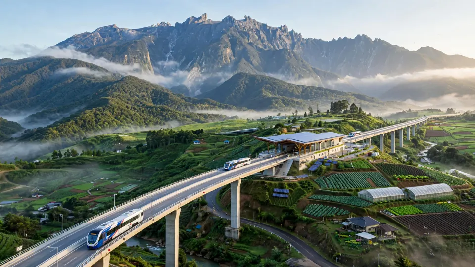
DISCLAIMER: Sabah Transit Line is an independent conceptual proposal. It is not an announced government project, nor a real project. This is purely conceptual, imaginary vision. The 455-kilometre KK–Lahad Datu alignment used in this article is an illustrative planning scenario. Its eventual distance, route, cost, travel time and fare would have to be established through surveying, engineering and a full business case.
Introduction
When doing long-distance travel, our transportation system still heavily depends on our existing road network. This makes travelling between major towns slow and most of the time difficult to predict. Google Maps says it takes 2 hours and 30 minutes to drive from Kota Kinabalu to Keningau through Tambunan, and yet it still took us 3 hours most of the time, where besides the terrains, we also need to take account of the traffic and sometimes the constructions - during the holiday season, you can have cars literally lining up behind lorries en-route to Tambunan.
While flights solve the speed problem, it's only available to small set of destinations, namely prime cities that has operating airports. Besides, flights also introduce another set of limitations: from ticket pricing and availability, to airport procedures, down to flight being cancelled. This makes conventional buses to still be the choices for many travellers, despite that they are affected by the same road situations as every other vehicle.
How about train service? Currently, our only train service runs from Sembulan, Kota Kinabalu to Beaufort, on a very classic train and line, which were built back during the British era. And given how limited the stops are, and the lack of initiative and efforts to expand the train service to other places, I don't think we can have good train service somewhere near in the future (or maybe in 50 years?)
This is why I am proposing a different approach.
Imagine the cost efficiency of operating buses and freight vehicles, but on a separate, dedicated, covered lane exclusive, and only for these vehicles. It's something like the BRT line in Sunway, but extended to cover many corridors in many parts of Sabah.
I call it Sabah Transit Line, or STL.
What is Sabah Transit Line?
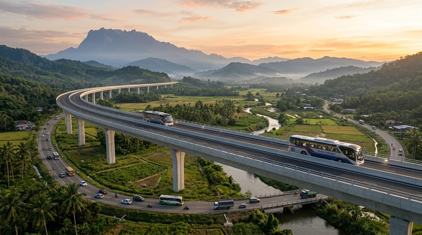
Sabah Transit Line is a proposed intercity public transport system that uses high-performance coaches on their own dedicated infrastructure.
It is not an ordinary BRT lane beside an existing road. It is not an express bus operating on the Pan Borneo Highway. It is also not a railway, ART system or maglev.
STL would have:
- one protected lane in each direction;
- complete physical separation from ordinary traffic;
- no at-grade crossings, traffic lights or uncontrolled junctions;
- access limited to certified STL vehicles;
- ground-level construction where the terrain permits;
- raised viaducts where a straighter or smoother alignment is needed;
- stations outside the running lanes so express vehicles can pass stopping services;
- centralised traffic control, telemetry and electronic speed supervision;
- scheduled passenger services during the day and evening;
- a controlled logistics window during the night;
- permanent access for authorised emergency and recovery vehicles.
In essence, this is what STL is:
The vehicles are coaches, but the infrastructure and operating discipline behave like a railway.
The main unique selling point is not just a high maximum speed. It is the ability to sustain a commercial average velocity a 100 km/h across a long journey, without being delayed by ordinary road traffic.
But why 100km/h? Why not 120km/h? Or 250km/h?
Because 120km/h and 250km/h are overkill, and this is bus system, not train service.
Also, averaging at 100km/h makes the calculation for estimated time of arrival to be more simple.
For example, a journey from KK to Sandakan is around 450km. At 100km/h, one can simply say:
4 jam stangah saja ba naik STL dari KK pigi Sandakan
"It only takes 4 and a half hour to travel from KK to Sandakan by STL"
The distance and the travel time can be interchangeably used with almost 1:1 conversion.
Of course, this is not the velocity that the coach will move from start to end. This is the commercial average velocity, where the velocity is derived from the scheduled departure at the origin station to the scheduled arrival at the destination, which also includes any intermediate station stops, acceleration, deceleration, and a small timetable recovery allowance.
For example, taking the same example journey from KK to Sandakan, a plausible express timetable could be structured like this:
| Component | Time |
| Vehicle in motion | 255 minutes |
| Five intermediate stops at two minutes each | 10 minutes |
| Distributed timetable recovery | 8 minutes |
| Total scheduled journey | 273 minutes - 4h 33m - 4.5h |
During the 255 minutes of movement, the vehicle would have to average approximately 107 km/h. This means the coach would cruise at around 110–120 km/h over long, suitable sections, while the civil alignment would be designed for up to 130 km/h.
A completely separate corridor
STL will employ a completely separate corridor for its operations, and will never operate in tandem with the ordinary traffic. This means, the STL coaches will never enter into a congestion, sharing lanes with private cars, or being delayed by roadside junctions. STL vehicle will use the a dedicated protected line, where the line it will operate on will be a protected infrastructure, with access is only given to these vehicle groups:
- Certified STL passenger coaches
- Certified STL logistics vehicle operated within the allocated slots
- Authorized emergency vehicles
- STL maintenance and recovery vehicles
All other type of vehicles are strictly prohibited from entering and using the STL corridor in any way.
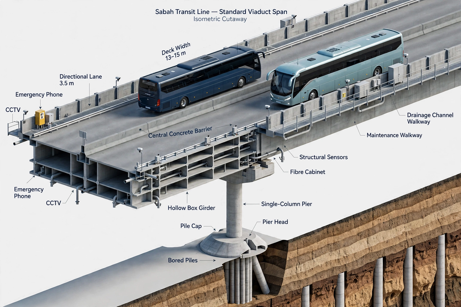
A typical rural STL deck would be approximately 13–15 metres wide:
| Element | Concept dimension |
|---|---|
| Directional running lanes | 2 × 3.5 m |
| Central separation and barrier | Approximately 0.8–1.0 m |
| Outer shoulders and clearances | Approximately 2.0–2.5 m each where feasible |
| Barriers, drainage and maintenance walkways | Remaining structural width |
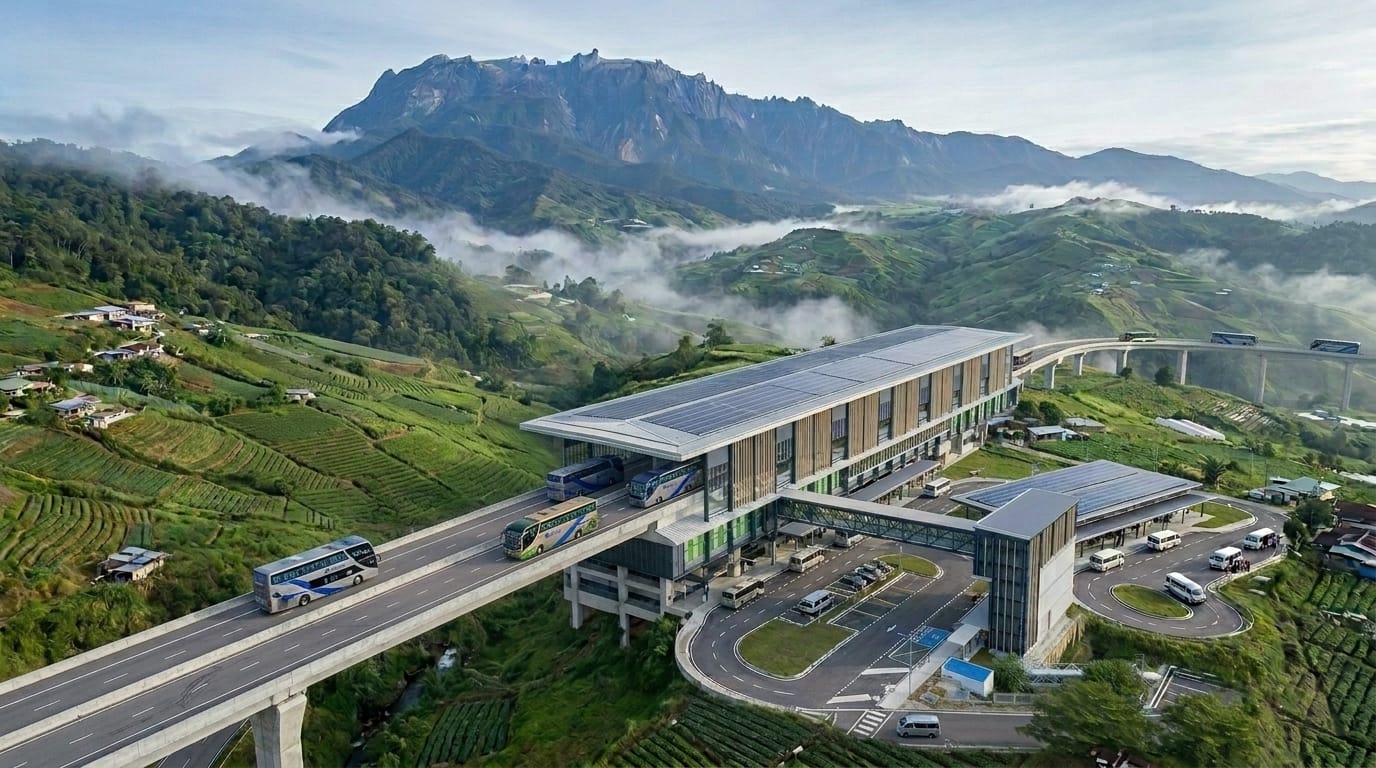
Stations must sit outside the running lanes. A stopping coach would use a deceleration lane, enter the platform area and later rejoin through an acceleration lane. Express services would remain on the through alignment.
Overcoming the Sabah's terrain using viaducts
STL has one primary job; move passengers safely and predictably between cities and stations, periodically and with schedules.
The viaducts of STL was imagined to be built near to the existing road networks in most places, following the road for the routes. But there are situations where this is impossible, like for example, in heavily dense city, or in routes where the road is very windy and curvy.
To solve this, STL should not strictly follow the geometry of the existing road networks. The line can therefore:
- follow broad valley contours;
- cross rivers and ravines directly;
- rise gradually toward mountain saddles;
- pass above local roads and agricultural access;
- avoid unnecessary entry into settlements;
- maintain longer curves suitable for sustained speed;
- keep wildlife and water movement beneath the structure.
How about using tunnels for elevated terrains?
Tunnels can be considered, if it's proven than building a tunnel is safer, cheaper, and easier than building viaducts with the same length. But most of the time, for mountain alignment, the viaducts will gain elevation over a longer horizontal distance.
For example, if the line needs to gain 700 metres of elevation, at 4% sustained gradient, the horizontal distance required should be around 17.5 km in length. The preferred sustained gradient should remain around 3–5%. Short 5–6% sections are workable. An exceptional section approaching 8% may be possible at reduced speed, but it should not become the normal design.
But why viaducts? Why need a lot of it?
Viaducts can reduce the amount of continuous land occupied by the finished line. Streams, farm roads and many wildlife movements can continue underneath. Piers should preferably remain outside active river channels, while sensitive forest sections can use longer spans and top-down construction.
This does not mean viaducts have no impact. Piers, construction access, noise, lighting and visual change still require assessment and mitigation. The advantage is that these impacts can be concentrated into specific, measurable locations rather than forming one continuous ground-level barrier.
The Lines, the Stations, and the Vehicles
This section will discuss the 3 core components of STL - the planned lines, stations, and vehicle.
1 - The Lines:
Below are the few lines (routes) that were imagined for full STL operations:
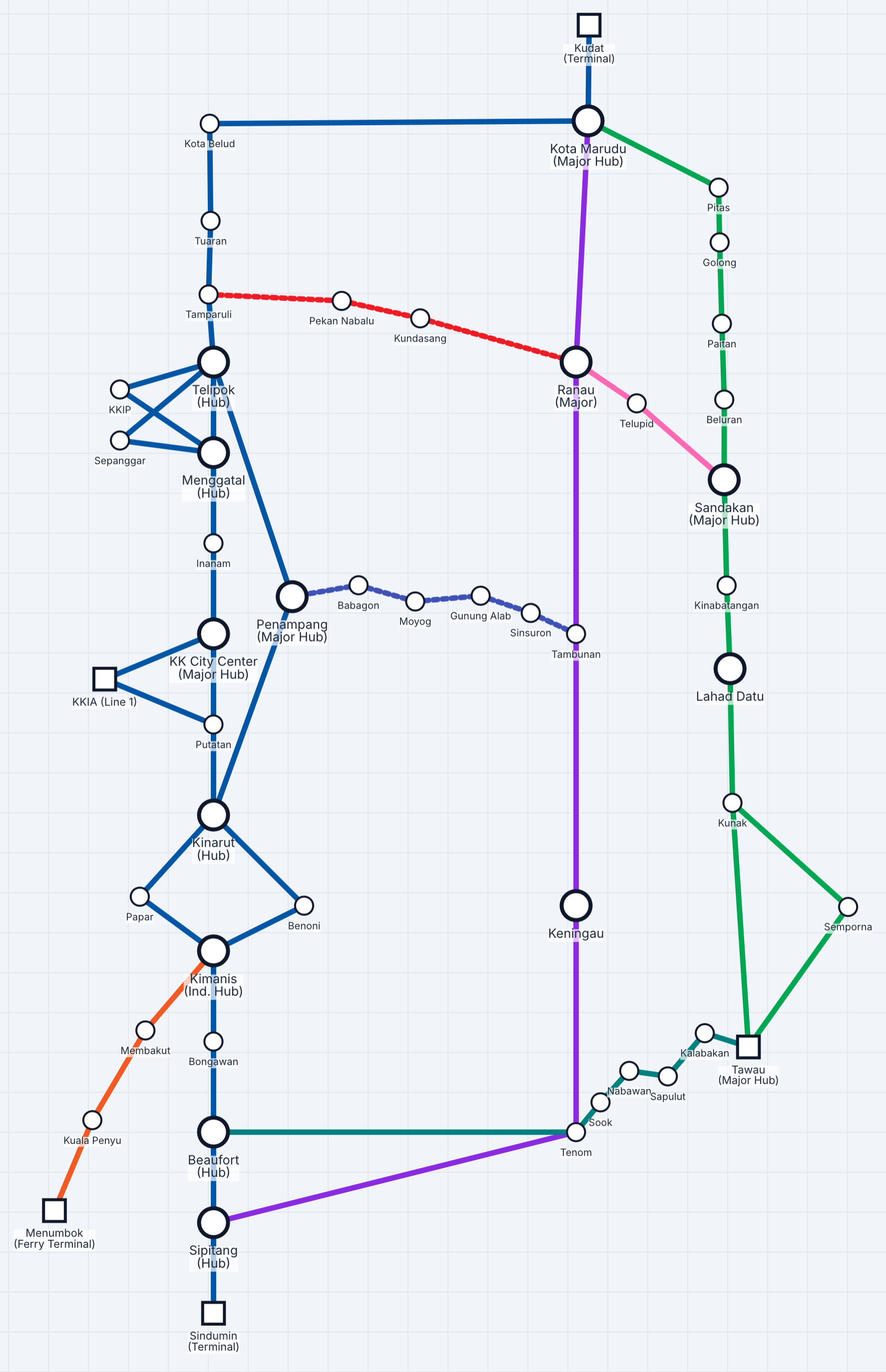
West Coast Corridor
This will serve as the main line for the west coast division of Sabah, especially the coastal cities and districts. For this corridor, the following stations were envisioned:
- Kudat (Terminal)
- Kota Marudu (Major Hub)
- Kota Belud
- Tuaran
- Tamparuli (Minor Station)
- Telipok (Divergence-Convergence Hub)
- KKIP
- Sepanggar
- Penampang (Terminal)
- Menggatal (Divergence-Convergence Hub)
- Inanam
- Kota Kinabalu City Center (Major Hub, Major Station)
- line 1:
- KKIA
- line 2:
- Penampang (Major Hub, Major Station)
- Telipok (Terminal)
- line 1:
- Putatan
- Kinarut (Divergence-Convergence Hub)
- - split between 2 cities -
- Papar
- Benoni
- Kimanis (Industrial Complex Hub, Major Hub)
- Bongawan
- Beaufort (Minor Hub)
- Sipitang (Minor Hub)
- Sindumin (Terminal)
Menumbok-Kuala Penyu-Membakut (MKPM) Line
This line will serve as the main line connecting the West Coast Corridor to the Menumbok Ferry Terminal for travel to Labuan. The following stations were envisioned:
- Kimanis (connecting station to the West Coast Corridor)
- Membakut
- Kuala Penyu
- Menumbok (Terminal)
East Coast Corridor
This will serve as the main line for the east coast division of Sabah, especially the coastal cities and districts. For this corridor, the following stations were envisioned:
- Tawau (Major Hub, Major Station)
- Semporna
- Kunak
- Lahad Datu (Major Station)
- Kinabatangan
- Sandakan (Major Hub, Major Station)
- Beluran
- Paitan
- Golong (minor station)
- Pitas
- Kota Marudu (Terminal)
West Interior Line
This will serve as the main line for the interior part of Sabah, especially the west-interior part of Sabah. For this corridor, the following stations were envisioned:
- Kota Marudu (Major Hub, Major Station)
- Ranau (Major Station)
- Tambunan
- Keningau (Major Station)
- Tenom
- Sipitang (Terminal)
Akinabalu Connecting Line
This route serve as one of the connecting line from the west coast line to the interior line through the scenic Mount Kinabalu route. For this line, the following stations were envisioned:
- Tamparuli (Terminal)
- Pekan Nabalu (minor station)
- Kundasang
- Ranau (Terminal)
Penampang-Tambunan Connecting Line
This route serve as one of the connecting line from the west coast line to the interior line through the high-traffic Penampang-Tambunan route. For this line, the following stations were envisioned:
- Penampang (Terminal)
- Babagon (minor station)
- Moyog (minor station)
- Gunung Alab (minor station)
- Sinsuron (minor station)
- Tambunan (Terminal)
Intra-Coast Line
This line serve as one of the connecting line from the west coast line to the east coast line through the existing Sabah Train Service line. For this line, the following stations were envisioned:
- Beaufort (Terminal)
- Tenom
- Sook (minor station)
- Nabawan
- Sapulut
- Kalabakan
- Tawau (Terminal)
Interior-East Coast Line
This line serve as one of the connecting line from the interior line to the east coast line through the existing Pan Borneo line. For this line, the following stations were envisioned:
- Ranau (Terminal)
- Telupid
- Sandakan (Terminal)
Member discussion